Please put this address in your "{C}{C}{C}Favorites" folder so that you can return directly to it in future. It is designed to download quickly and simply give you information about walks that are organized without using any complicated layout elements or large images.
A walk number that is underlined has been altered since its original posting or is a new inclusion
Earlier walk programmes have now been removed from the web pages to save space, but copies including the reviews going back to 2001 may be obtained from Stan
Walking Group Mobile phone numbers are : 0754 6069085, 0752 2958435 & 0735 4800839 - Please note that the phones will only be operative on the morning of a walk to enable members who are running late, are lost or delayed, to contact the walk leader. If one number does not work, try the other
NB
1. Walkers are requested to carry both their U3A
membership cards and their ICE (in case of emergency) cards with
them on all walks and strolls.
NB 2. Members should consider carrying hand
sanitizer and a face covering. Members are urged to continue
with appropriate measures to minimise covid transmission.
NB 3. Numbers on walks are as always
at the walk leader’s discretion. This may well be limited. This may
depend upon a number of factors including any government diktats as
well as the nature of the walk, e.g. number of stiles.
NB 4. Where two walks
are offered in a week, if you wish to go on both walks please do not
book onto your second choice walk until the end of the week before.
This is so that members are not denied a place on any walk by early
second walk bookers.
Walk
1608
Thursday 7 March 4
miles Energetic Pub
lunch
Meet Tank Quarry WR14
4NA Grid SO 769470 9.45 for a
10.00am start
Contact Jenny and Mike 01684
772194 the week before
Directions Take A449 through Malvern, Left towards
West Malvern. Go past main car park and Clock Tower. Road up
to Tank Quarry picnic place on the left just past the Clock Tower.
Details We make a circuit of the Northern
hills. We start on the East side, climb to the roundel below the
Beacon (which we don’t climb)and return on the West. No stiles.
Short steepish climb at beginning. Easy walking but Energetic because
of.ascent.
Note We drive back to the Nags Head at Malvern Link for
lunch, WR14 2JG (plenty of road side parking). Please look at
Menu online and order lunch when you book the walk.
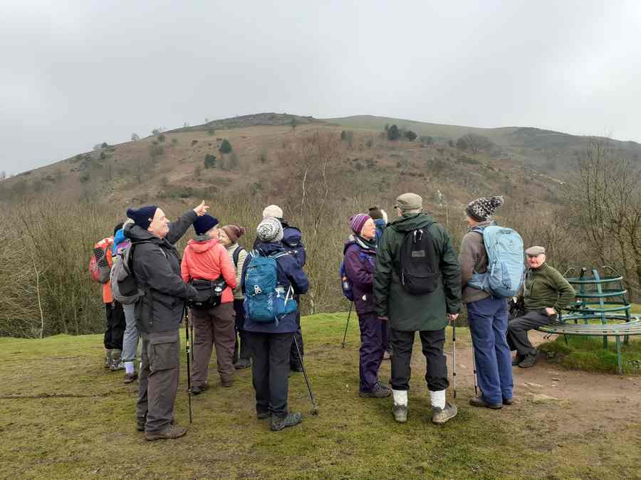
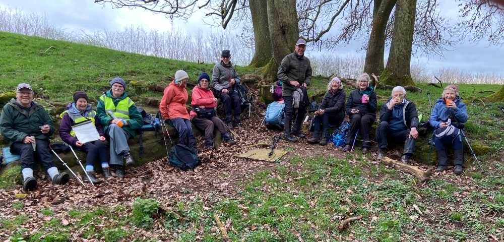
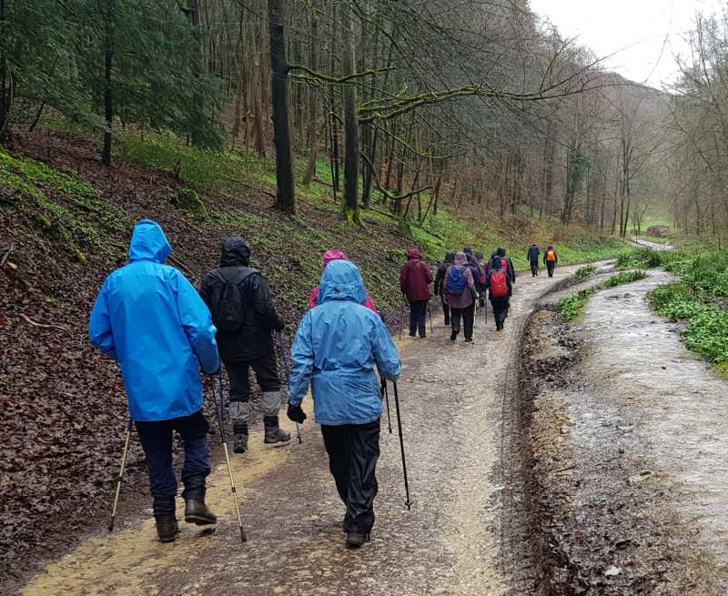
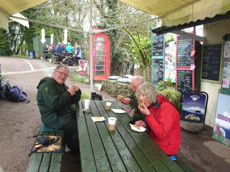
Finding the Tank Carpark unexpectedly closed, 15 of us gathered in front of the Clocktower. Starting our walk along the path through the Clock Tower car park, we stopped briefly to read the information board describing the East Malvern Fault, a reminder of the hill's turbulent geological origins. To me, walking on the Malverns always seems to be "UP" and so it was today until close to St Anne’s Well. There, we reached a grassy area with benches, giving us views looking down upon Malvern and up to North Hill. We continued uphill to the Indicator below The Beacon, before continuing along Lady De Walden's Drive, skirting around North Hill. Although the skies were grey, the views from the north side of the hill were as always most impressive. From here, we descended , at last, to the road at Tank Quarry, from where most of the company retired to the Nag's Head for lunch.
Thanks, yet again, to Jenny and Mike for a lovely walk in an area of the Malverns that was a little different for most of us.
Report by Jim; photos by Mike and Website by “Stub”
2. Pondering the Direction of the Nag's Head?
Stroll
Tuesday 12 March 1
mile Elmley Castle
village Possible pub lunch
Meet Opposite Queen Elizabeth Inn,
High Street, WR10 3HS, at 10.30am
Contact Angela and Chris
01684 294325
the week before
Directions From Tewkesbury, take A46 for Evesham. At
Teddington Hands roundabout go second Left, continuing along A46. After
5.5 miles turn Left signposted Elmley Castle & Hinton. Keep right to
Elmley Castle immediately after the this junction. After 2.8 miles enter
Elmley Castle village. At T-junction turn Left. At top of Main
Street; park in road opposite black & white Queen Elizabeth Inn.
Details A short route (I mile), mostly flattish, in this
attractive village under Bredon Hill. We’ll stroll on paths & quiet
roads, no stiles, entirely mobility scooter friendly
Lunch If any wish to join us, we shall probably eat at
the QE Inn (lunch 12 – 2pm) or there’s the Bredon Hill Country and
Café that you passed on the A46.
Note: It is Cheltenham race week and all eating places and the roads may
be busy.
Walk
1609 This walk is postponed until
Thursday 28th March - Same details.
Wednesday 13 March 3.25
miles Easy Lunch own arrangements
Meet Lay-by (old road) on the
B4632 road from Winchcombe to Cleeve Hill at south edge of Winchcombe,
GL54 5NH Grid 018277 for a 10.30am start
Contact Barry on 07751170833 (evenings) or by email
to bminettsmith@icloud.com the week before.
Directions To Winchcombe, then B4632 towards
Cheltenham, then as above.
Details A walk around Winchcombe and Sudeley Castle.
Note: Lunch - It is Cheltenham race week and all eating places and the
roads will be busy.
Walk 1610
Thursday 14 March 4
miles
Easy/moderate Lunch own
arrangements
Meet Church Lane, by St
Lawrence church, Mickleton, GL55 6RX, Grid 162435 for a 10.30 start
Contact Linda and Ken 01684 772030
the week before
Directions A46 towards Evesham, and turn right before
the town, to Childswickham. At the end of the village take the left-hand
fork up Pennylands Bank then turn left at the top. At the roundabout on
the A44, go straight across (2nd exit onto the B 4632 to Mickleton. Park
in Church lane (turn right off the High Street)
Details A varied walk, fields, lanes, and woodland,
starting with a gentle climb onto the Cotswold escarpment, passing
Kifstgate and Hidcote Gardens and through the pretty hamlets of Hidcote
Bartrim and Hidcote Boyce, one gentle climb, no stiles.
Note: Lunch - It is Cheltenham race week and all eating places will be
busy.
Following a walk over, Linda has had to change the walk completely. The old route was impassable due to mud.
Completely new details as follows:
-------------------------------
Change to walk 1610 Thursday 14th March Now 3.5 miles Moderate, pub lunch
Meet at Hollybush free car park off A438, grid 758368 for a 10am start. (Postcode HR8 1ET is closest)
Contact as before: Optional lunch afterwards at the Duke of York. Choose from the website and give order when phoning Linda on 01684 772030 to book for the walk by Friday 8th March.
Directions: A438 (over Mythe Bridge from Tewkesbury), straight on at staggered crossroads after Duke of York. Car Park is on the right at the brow of the hill.
Details: Walking south around Ragged Stone and Chase End Hills to Bromsberrow Park and back through White Leaved Oak, undulating lanes with some short inclines, and through woodland. Expect some mud, no stiles.
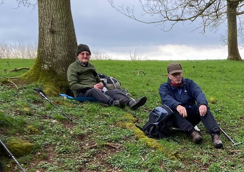
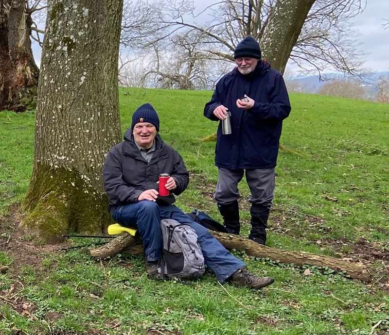
We met up at Hollybush car park and
commenced our walk south around Ragged Stone and Chase End
Hills. Although the weather was cloudy, the views of
hills across the Severn Vale were good and alongside the paths at
the edges of the woods, wild daffodils, wood anemones and
primroses were in flower amongst the leaves of the recently
flowered snowdrops.
We stopped for coffee in Bromsberrow Park at the foot of an old
tree with convenient logs, stones and raised ground for all 17 of
us to sit on in. Suitably refreshed and rested, we
journeyed on. As expected, there was some climbing to
do in the lanes before we descended the slopes.
Crossing a field, on the right we could see the site of the former
legendary 500 years old Sessile Oak tree which was burned in the
Summer of 2020. Upon reaching the hamlet
of Whiteleaved Oak where the boundaries of the 3 counties of
Hereford, Worcester and Gloucester meet and stocks are displayed,
we took the Worcester fork and climbed into an oak tree
wood. The first 15 metres of so were very muddy but
fortunately none of us lost our footing. Coming out of
the wood, we were then back at Hollybush for a change of shoes and
then on to The Duke of York for our lunch.
Whiteleaved Oak valley is named after a Whiteleaved Oak tree that
was cut down in Victorian Times, rather than the burned Sessile
Oak tree. After it was burned, some cuttings were
taken to be grown in the village but they did not
survive. A project has now been set up by Gary
Biltcliffe to grow rare Whiteleaved Oaks in memory of this Sessile
oak. The plan is to re-introduce the Whiteleaved or
Variegated Oak Quercus Robur “Albomarmarata” to the
valley. These rare Whiteleaved Oak trees can be
found in Westonbirt Arboretum near Cirencester, Childwell
Park, Liverpool and the National Trust property, Biddulph Grange
in Stoke on Trent,
Thank you, Linda, who is a new member, and her husband Ken for
leading the walk. (Thanks also to Paul for the wonderful
report ant to Phil for his photos - SF)
The rest
of Us
Walk 1611
Wednesday 20 March 4.5 miles.
Easy/Moderate possible pub lunch
Meet Bourton Vale Car Park
GL54 2LU Fee of £6 for 4 hours for a 10:00
start
Contact Andrea and Bob on randawalton@googlemail.com
or 01684 294676 the week before
Directions A46 through Ashchurch, then B4077 turning
right onto Buckle Street, signposted to Bourton on the Water, cross the
A429 onto Lansdowne Rd, to the High Street, car park is on this
road.
Details This is a circular walk,
from Bourton to the village of Wick Rissington and back, mostly through
countryside but some sections on roads and lanes. It is mostly flat but
with a 44 metre rise overall. It could be muddy as it is mostly on low
lying ground.
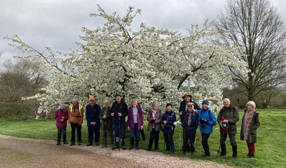
Andrea led 16 of us from the Village
Inn in Twyning , as an alternative to their advertised walk.
Following the footpaths towards Church End we encountered the only
patch of mud on the walk.
We crossed the Ace cross country field and skirted the village to
our coffee break viewing the "New Manor".
The climb up to Hillend took us past a beautiful cherry tree,
which gave us a photo opportunity.
Back to Lunch at the Village Inn and thanks to Bob and Andrea for
arranging a pleasant end to the walk.
(THanks to Sonia for the report and to Andrea for the lovely
Spring photo - SF)
Blossom
Walk 1612
Cancelled for personal reasons
Thursday 21 March
6 miles Moderate
Pub lunch
Meet Beauchamp Arms, Dymock GL18
2AQ Grid 700312 9.30 for 9.45 start.
Contact Terry and Margaret 01684 7722278 the
week before
Directions M50 to J2 Right over motorway on A417, Left
in half mile through Bromsberrow Heath & Brooms Green to B4216. At
Greenwood, turn left to Dymock 1 mile, turn right, pub on right, parking
on left and in field if possible.
Details Another walk in search of daffodils. Some
fairly easy undulation, with a few Stiles and muddy patches. Mainly
on field, track and quiet lanes.
Lunch: please choose from the pub menu when booking the walk the week
before.
report
Walk 1613
Wednesday 27 March 5 miles
Easy/Moderate Possible NT cafe lunch
Meet Woodchester Park NT
Buckholt car park - off B4066 Stroud to Dursley road, Grid 797015 (1
km NW from Nympsfield village GL10 3UA) 09.45 for a 10.00am
start
Contact Hugh and Sue 01452 780460 the
week before
Directions M5 J13, then A417 towards Stroud, at
roundabout just before Stroud take B4066 towards Dursley, follow the brown
signs from the B4066 to NT Woodchester Park. Park in NT Buckholt car
park, free for NT and NT for Scotland members. £3 all day for non-NT
members (no change from ticket machine). Note: do not follow signs to
Woodchester Mansion or NT directions to the NT Tinkley Gate car park.
Details A walk along the north side of Woodchester Park
lakes, and returning along the south side; mainly following contour lines
but with some gentle uphill slopes. Forest tracks and footpaths, no
stiles.
Possible lunch at NT cafe at Tinkley Gate, use postcode GL10 3UH to find.
Sadly the pub in Nympsfield is closed and for sale.
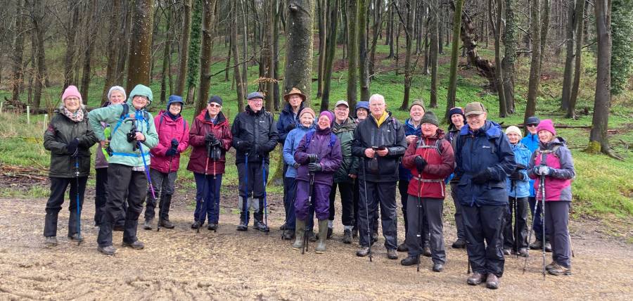
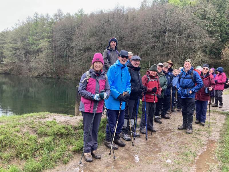
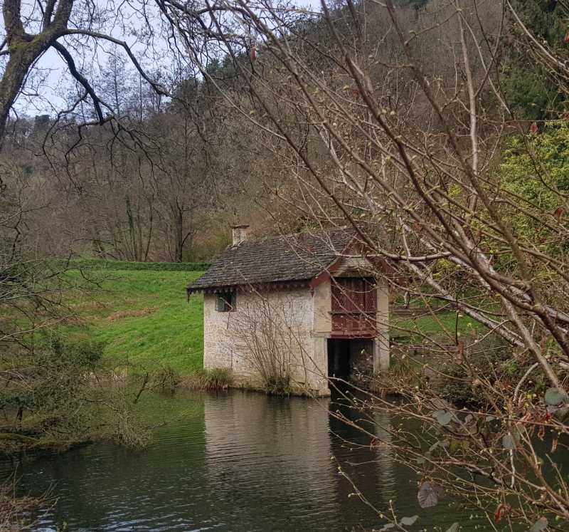
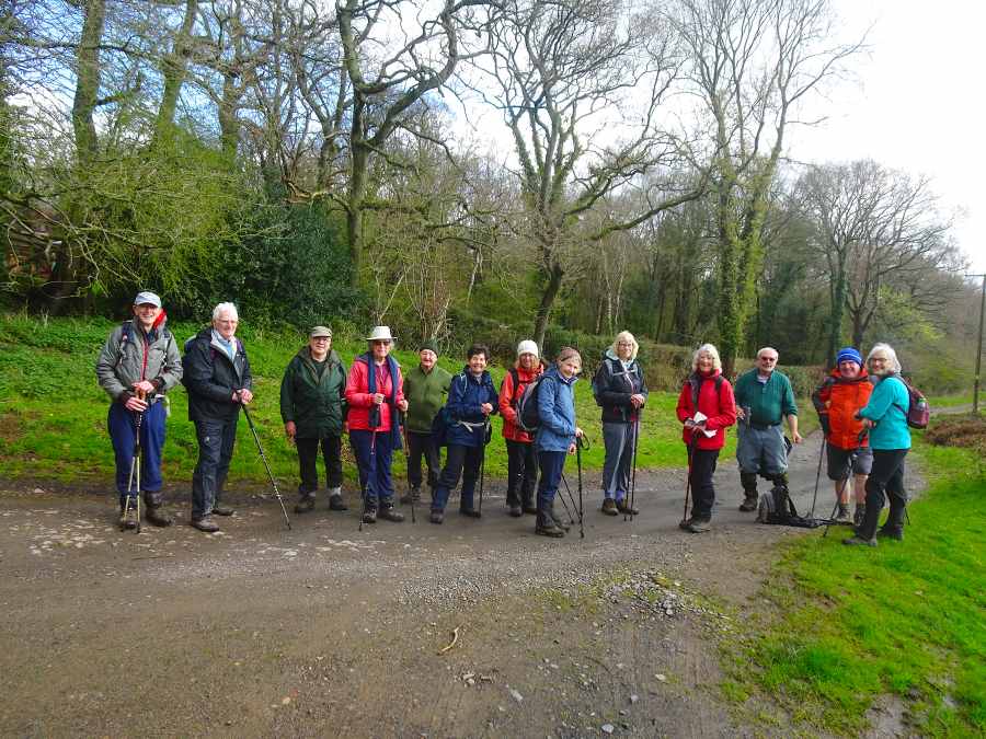
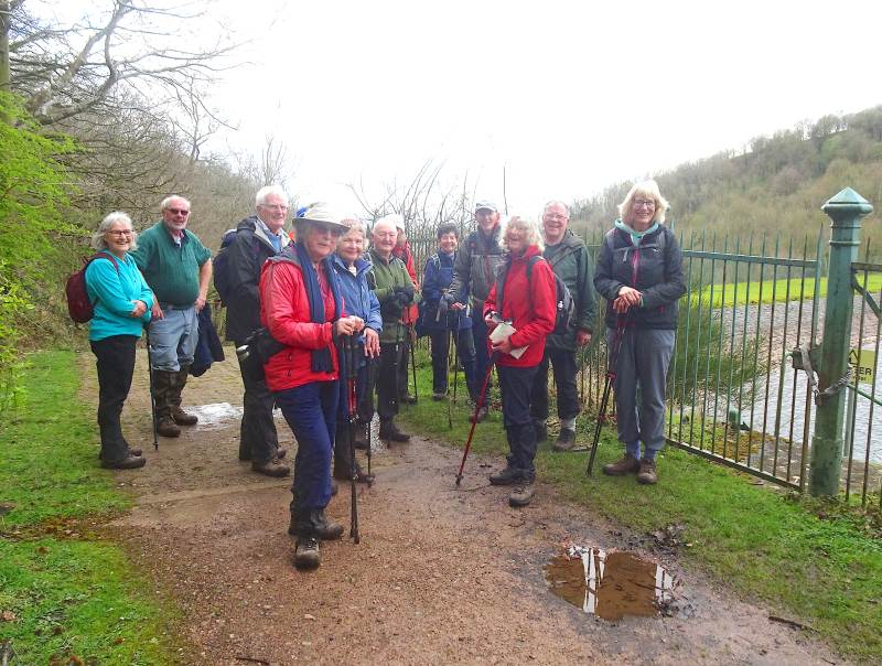
‘A brave twenty of us made are our way to the car park at Woodchester Park on a cold and soggy morning. We set off for our walk around the lakes and we were rewarded by the rain eventually ceasing and we had a pleasant walk through the woods and along the lakeside(s). The smell of garlic beginning to appear was evidence of spring along with one or two bluebells. Most of us had a tasty lunch in the NT cafe at Tinkley Gate’(Report by Meg, photos by Sylvia ans Jim)
The group picture (Sylvia)
By the lake (Sylvia)
A cold start (Jim)
Walk
1614
Thursday 4 April 5 miles
Mod/Energetic Picnic lunch
at end of walk
Meet Mill Pond, Golden Valley,
Hollybed Common, Near Malvern, WR13 6AA, Grid 777371 for a 10.00a.m.
start
Contact Graham & Betty 01684 594331 or
email graham.mealand@btinternet.com the week before.
Directions A438 Tewkesbury-Ledbury Rd. After Duke of
York pub, turn right at X.roads onto B4208. In 1.5 miles turn left signed
Golden Valley, park near Mill Pond in 0.5 mile.
Details Great views from Golden Valley, as we gradually
climb towards the Malverns across commons, then steepish past British Camp
reservoir before refreshments at British Camp cafe/toilets. Return lower
slopes of British Camp to Castlemorton Common, retracing path to Mill
Pond. Picnic by Pond if weather favourable.
Please note that Graham and Betty's landline telephone 01684594331 is not
working at the moment but their mobile telephone 07587813326 and email
address are OK.
As
we met together by the duck pond on Castlemorton Common we were so
glad the BBC weather had changed from it’s original rainy forecast
to a more promising walk. However, when the 14 of us set forth the
deluge from the night before greeted our footsteps as we sloshed
forward. It’s a trek that most of us had done before and we soon
forgot our waterlogged feet as we caught up on news .
A water stop on the edge of the common about half way towards the
British Camp Kiosk coffee stop refreshed us before the steep
upward climb by the side of the now full reservoir. The best way
to survive this ascent is to enjoy an interesting conversation as
you climb and you don’t notice the pain! We soon ordered a variety
of drinks and eats at the Kiosk but beware the pizza size Bacon
Butty ( ask Noel for details)
Mums & children enjoying the last days of the Easter school
holidays walked with us as we started on the second half of our
walk on firmer footpaths along the side of the British Camp.
But another crossing of that Common had to be tackled as we
sloshed our way back to the cars for a picnic lunch , taking care
to hide from the ducks! Boot cleaning ahead back home but we
survived a wetter than usual underfoot experience. (Report and
photos by Graham)
Stroll
Tuesday 9 April 1.25 miles
Forthampton village
Meet Forthampton village hall car
park GL19 4QB Grid 854326 for a 10.30
am start
Contact Hugh
01452 780460 the week before
Directions Over Mythe bridge then A438 Ledbury
road for about 2 miles, turn left to Forthampton. At cross roads in
village, straight over on no through road, village hall car park on right
after 200 metres.
Details Mainly metalled lanes with about 600 metres in
the middle on an easy footpath alongside fields. One short downhill
section to begin with and one gentle uphill section to finish. No stiles.
Unsuitable for mobility scooters on footpath section.
report
Walk 1615
Thursday 11 April 4 miles
Moderate Lunch at the Orchard Restaurant at Hayles Fruit
Farm.
Meet Hayles Fruit Farm, GL54
5PB Grid 054298 for a 10.00 start. Ignore signs to the campsite on
the left, where the lane ends, turn right to the farm. After *parking (see
below), collect a parking ticket from the restaurant.
Contact Linda on 01684 772030 Choose lunch from website
menu and give order when phoning to book for walk by Friday 5th April.
Directions A46 from Tewkesbury to Teddington Hands
roundabout, then third exit onto B4077 to Toddington. Turn right at
roundabout 2nd exit onto B4632 (sp. Winchcombe) then 3rd left on lane
following signs to Hayles Fruit Farm. *Drive through the first car park
and follow the track past the farm buildings to the second (tarmac) car
park on the left.
Details An initial climb taken gently onto the
Cotswolds, then through the Farmcotes and back past Hailes Abbey. Tracks,
lanes and the Gloucestershire Way. No stiles. Good views on a clear day.
report
Walk 1616
Thursday 18 April 6 miles
Moderate/Energetic
Lunch Pub/Picnic
Meet Green Dragon Pub Cockleford GL53
9NW Grid 971141
10.00 Start
Contact Sonia 01684
298409 the week before
Directions M5 South to J11A, A 417, A436 to Seven
Springs, A435 towards Colesbourne. Third turning on the right to
Cockleford. Car Park off lane opposite.
Details A walk on quiet lanes, fields and tracks through
attractive Cotswold villages
with views over the Churn Valley. One steady uphill climb, one downhill
section with possible loose stones and several stiles.
N.B. We have to cross the busy A 436 opposite The Hungry Horse Pub, so we
will need to cross with caution. Will advise necessity to book Pub in
April on booking.
report
Walk 1617
Wednesday 24 April 5 miles
Moderate Pub Lunch
Meet Royal Oak, Bredon
GL20 7LW Grid SO 925 369
9.45 for a 10am start
Contact Mike and Jenny 01684
772194 the week before
Directions B4080 from Tewkesbury. Royal Oak is on
your right before the railway bridge. Car park is behind the pub.
Details We walk to Bredons Norton for a coffee stop in
Northcroft garden where the fritillaries may still be in flower. We return
via Westmancote. Mainly field walking, two stiles.
Lunch 1.15pm. Order when you book. Menu on main u3a
website – groups – walking - upcoming walks.
report
Walk 1618
Thursday 25 April 4
miles Moderate
Hotel lunch
Meet The Slaughters Country Inn,
LOWER Slaughter, GL54 2HS, Grid 165225. Car park behind the
inn. If not having lunch, park on straight road outside inn or
outside church 50m away, order lunch from 9.30 for a 10.00am start.
Contact Noel 01684 772526 or
ngslaney@gmail.com the week before
Directions B4077 to Toddington and Ford. After
1mile or so (crossroads) turn right onto long, straightish country lane
for 4miles crossing over B4068; 1mile later turn left onto narrow lane for
the Slaughters. Turn 1st right, then 1st left for Lower
Slaughter, Inn on right.
Details Paths and lanes around the two Slaughters; soft
going on some low lying paths with 3 short, gentle climbs. No
stiles. Views of Bourton Vale and Wolds.
Lunch menu at
https://www.theslaughtersinn.co.uk/dining-drinking/restaurant-bar. Note
this is a comparatively expensive 3 star hotel e.g. soup £8.50,
baguettes £11ish.
report
Notes for Guidance
Information for all members (revised July
2020)
Group Leader Walks
Co-ordinator
Treasurer
Sylvia Murdoch
Hugh Bennett
Tony
Barrett
01684 437462
01452 780460 01684 276960
sylviamurdoch@outlook.com
candhbennett@gmail.com
tonyandjenniferbarrett@btinternet.com
Walking
Group mobile phones: 07546069085 and 07522958435
Details
of all walks and reports can be seen at
http://home.freeuk.net/stanfagg/u3a.html
Nearly
all the photos on this page have been reduced in size and resolution
to save both space and bandwidth. Should you want a copy of any
of the photos, Stan would be happy to supply a copy of the original
file - just quote the walk number and the photo title.
To go to The Tewkesbury U3A main site click here; Tewkesbury U3A
Contacts:
Sylvia (Group Leader) 01684 437462
E Mail sylviamurdoch@outlook.comHugh, (walks coordinator) 01452 780460 E Mail candhbennett@gmail.com
Webmaster . . . Stan Fagg stanfagg@freeuk.com Updated 8th April 2024