|
Byker Wall
Sat. 2nd Dec., 2000
|
|
The Roman Emperor Hadrian built one at the turn of the last millennium; in Newcastle during the late 1960s it was a bright
idea.The eastern suburb of
Byker, separated from the city
centre by the Ouseburn valley, grew as a 19th century domicile for the burgeoning workforce required by shipbuilding and other heavy industries centred on the River Tyne at the foot of its steep banks.The
thriving community that existed here was relocated whilst the "Byker Wall" was erected. Later, residents were injected back into the new development as if nothing had changed. This was rather
optimistic and naive. |
 |
|
|
 |
|
The chief architect, Ralph Erskine, and project leader Vernon Gracie consulted widely with the residents before anything was done. They
wanted to maintain the communal identity. This plan the proceeded from 1969 to 1971 then vast swathes of housing were demolished and the north facing wall here seen with its tiny windows and impenetrable brickwork was
designed to insulate against the cold and the noise from the planned Byker By-pass. The pigeons were not rehoused. |
 |
|
|
|
|
|
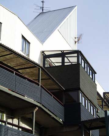
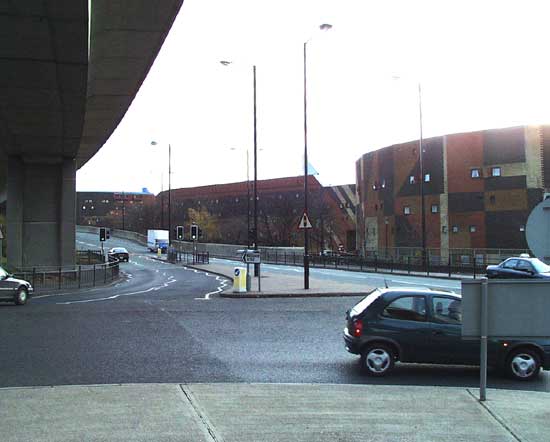
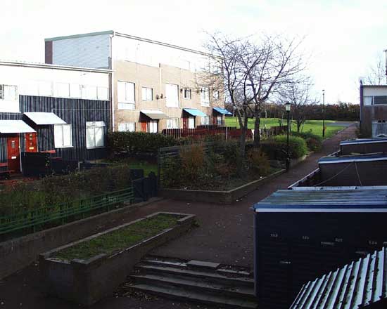
Heading south from the wall, the new housing is arranged in a seeming haphazard pattern of small squares bordered by these
small curtain blocks with deck access. The motor car is almost completely eliminated from this district. Parking areas are strategically placed at the edges of the complex.The balconies and large windows
face south, commanding sunshine and an unrivalled view across the Tyne valley. A variety of shapes and materials have been used in the construction to instil feelings of individuality and belonging in the
residents. |
|
|
|
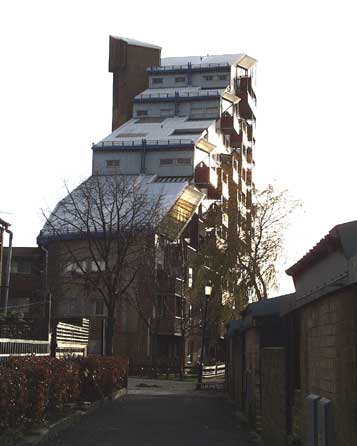
The wall varies between five and nine storeys high, but this stand alone block, Tom Collins House, stands amid the lower
housing in the middle of the development.It looks like the blueprints were badly folded and jumbled up with a garden shed! I think it is very striking, and this estate was a showpiece of 20th century
urban development. Visitors from around the world came to see the marvellous and daring architecture. Although much consultation took place, the community never really recovered from the destruction of its
built environment. The lesson had yet to be learned that a community is not just the people, but is their interaction with their surroundings. |
|
|
 |
|
|
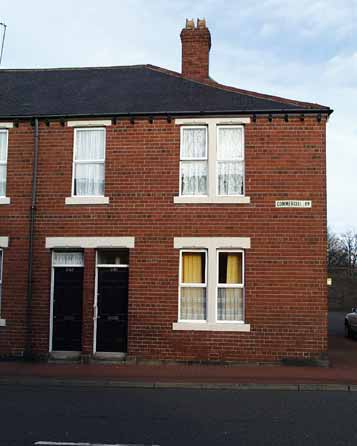
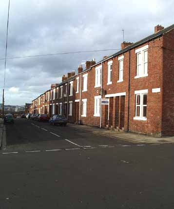
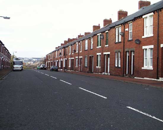
So, what was the older Byker like? Here is Commercial Road, one of the existing sections that was not demolished. Apart from the
satellite television aerials nothing much has changed. These remnants are the better housing stock from the original, it is without doubt that Byker did contain some poor housing arising from the excesses and ignorance
of 19th century industrial expansion. |
|
|
|
|
|
The mainstay of housing was the Tyneside Flat. Two separate dwellings were built one above the other. The front door nearest
the lower floor window lead to the ground floor, and the adjacent door lead directly to stairs leading to the upper and usually larger flat. |
|
|
|
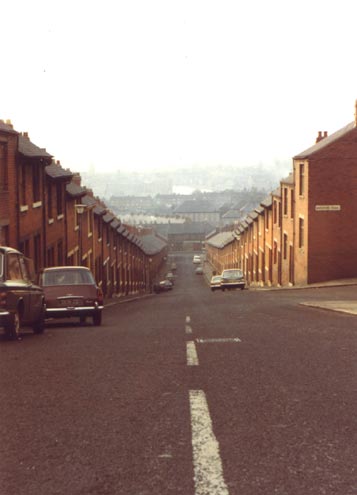
Here is Avondale Road in 1972. At the foot of the street is Raby Street, and beyond is remainder of Byker ending in Brinkburn
Street, at the edge of the Ouseburn valley running right to left, joining the River Tyne beyond to the Left. The River Tyne can be seen directly ahead.This picture was taken on a cold October Sunday
morning and the haze is probably the result of all of those early morning coal fires being stoked up. The Clean Air Act was widely ignored in this area until the new housing was built. Below is the same
scene today and the clarity of the air is obvious, as is the changing landscape. |
|
|
 |
 |
|
|
|
Photo copyright W. A. Camwell |
|
|
|
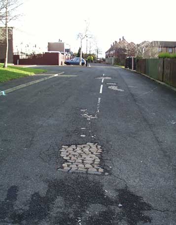
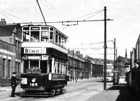
This is Walker Road, at the south end of Raby Street in 1935. The tram has just finished its journey and is about to start up
again, and will turn left up Raby Street opposite the telephone kiosk. The trolleybus in the background will have to wait for the tram to clear the wires before carrying on it journey to the city.To the
right is what remains of Janet Street, its cobbles showing through the thin asphalt covering intended to "modernise" the area. Here the original housing has been replaced by neighbourhood squares, and no
road actually leads anywhere. |
|
|
|
|
|
|
|
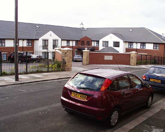
Nearby Ayton Street looks relatively untouched in this westward view, but it is quite different on the opposite side.Below
is a view of Balmoral Court, a rather up market development. High gates, security cameras and grilles, and a private haven hedged against those nasty natives just poised to steal your hard earned goodies.
There is further evidence of this "stockade" mentality to housing. Locking out the great unwashed is hardly the route towards building an integrated and happy community. |
|
 |
|
|
|
|
|
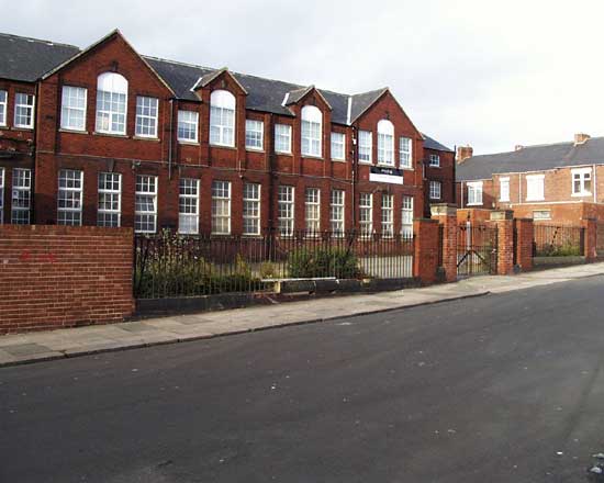
Just around the corner is Bolam Street School, sparking memories for many, I expect. It is now a training centre for the City Council
Public Works Department. |
|
|
 |
 |
|
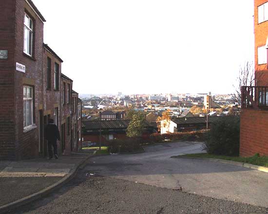
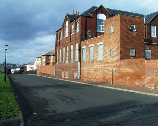
This is Bolam Street looking west towards St. Peter's Road. It used to extend, as did all of these streets, to Raby Street and Brinkburn
beyond. This is all that remains today. Below is the parallel remnant of Kirk Street. Previously pictured Janet Street is below this, and the area between Kirk and Janet Streets is now Janet square. |
|
 |
 |
|
|
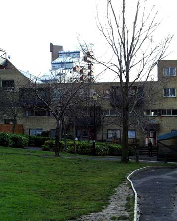
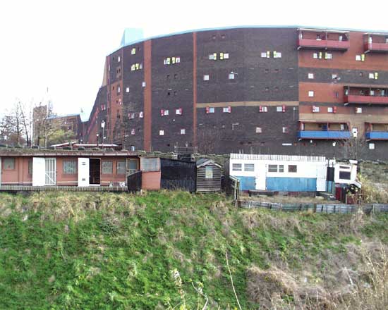
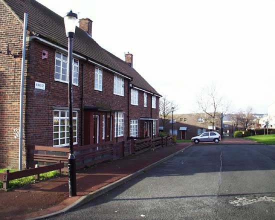
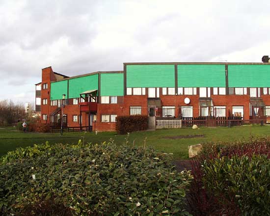
St. Peter's Road is now the boundary for the main traffic free housing area. Below is the south eastern edge of the Wall development. Its
low rise and position at the foot of the slope allow others higher up to have those fabulous views and sunshine. The development as a whole is not a community success, as the number of empty and vandalised properties
attest. On the brighter side, the Council and local action committees are attempting to stop the rot, but I suspect that the effort is at least a decade too late. |
|
 |
|
Some may mourn the passing of the older housing stock with its closely knit community; but do they really want open coal fires belching
sulphurous smoke and filthy back alleys only just saved from outside toilets and earth closets? Those damp and grimy streets are gone forever and the housing is now more spacious, but thanks to the innovative use of the
vertical is about the same density. Perhaps it was too ambitious to expect that the old community could be re-injected when some of the people returned in the mid 1970s, but is it too much to hope that a new and vibrant
community may still develop in this predominately sunny and optimistic location? |
|
|
|
Click here to see high quality album copies of these and other
photographs from the same shoot |
|
|
|
|
|
 |
|
If you should arrive here via a search, or be missing the navigation on the left hand side, click this button.
|
|