|
|
 |
|
|
|
|
|
 |
|
|
|
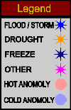
Global Warming Monitor tracks the world�s most serious climate-related disasters thought to be caused or intensified by Global Warming. Floods, droughts, severe storms, avalanches, landslides, wildfires and heat and cold waves are becoming increasingly common, severe and unpredictable. GWM plots events geographically and temporally at the continental and regional levels. Geographical patterns reveal the scope and intensity of occurrences over a 13-week period of time. |
|
|
|
|
|
|
|
Global Warming Monitor shows locations and descriptions of the most recent events and time sequence maps depict the 13-week history. Click on maps for more detail, or select a country. |
|
|
|
|
|
|
|
 |
|
|
|
|
|
|
The Global Warming Monitor is an independent site controlled by Loveday Geographical Services, England. Ideas, suggestions, data sources and sponsorship of any sort are welcomed. Various GWM products may also be available. Contact Global Warming Monitor. |
|
|
|
|
|
|
|
|
|
Please contact our Webmaster with questions or comments. |
|
|
|
Copyright 2000 Loveday Geographical Services, London. All rights reserved. |
|
|
|
|