Please put this address in your "{C}{C}{C}Favorites" folder so that you can return directly to it in future. It is designed to download quickly and simply give you information about walks that are organized without using any complicated layout elements or large images.
A walk number that is underlined has been altered since its original posting or is a new inclusion
Earlier walk programmes have now been removed from the web pages to save space, but copies including the reviews going back to 2001 may be obtained from Stan
Walking Group Mobile phone numbers are : 0754 6069085, 0752 2958435 & 0735 4800839 - Please note that the phones will only be operative on the morning of a walk to enable members who are running late, are lost or delayed, to contact the walk leader. If one number does not work, try the other
NB
1. Walkers are requested to carry both their U3A
membership cards and their ICE (in case of emergency) cards with
them on all walks and strolls.
NB 2. Members should consider carrying hand
sanitizer and a face covering. Members are urged to continue
with appropriate measures to minimise covid transmission.
NB 3. Numbers on walks are as always
at the walk leader’s discretion. This may well be limited. This may
depend upon a number of factors including any government diktats as
well as the nature of the walk, e.g. number of stiles.
NB 4. Where two walks
are offered in a week, if you wish to go on both walks please do not
book onto your second choice walk until the end of the week before.
This is so that members are not denied a place on any walk by early
second walk bookers.
Meet
Ashchurch village
hall, Ashchurch, Tewkesbury GL20 8JY at 1.45
for 2.00pm
Details Please contact Sylvia or
Hugh if you have anything you want to discuss under AOB on the Agenda.
Tea and
coffee will be served and donations of cakes will be very welcome.
We look
forward to seeing you all!
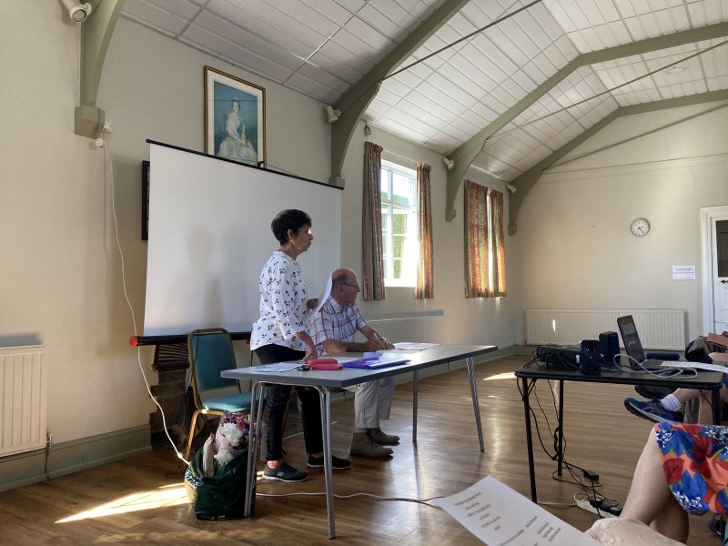
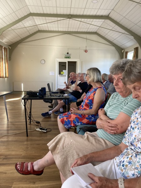
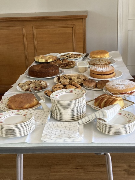
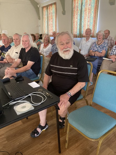
There was
a good turnout of familiar faces, old and new, for the annual
meeting, about 48 in all. Many people brought cakes to share.
Sylvia opened the meeting as Group Leader. She started with
the annual appeal for more people to come forward as walk
leaders. There are resources to share and many experienced
walk leaders who are ready to help any novices. Perhaps this
year more people will step up?
Sylvia also requested that people fill in and take with them
their ICE cards in case of accident or illness, and reminded
members that they must decide before asking to come on a walk
that they are fit enough to do it.
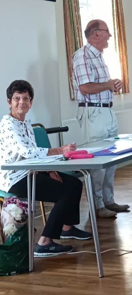
Hugh is the Walks Coordinator and he asked that leaders get
their walks to him by the 17th to 20th of the month before the
walk. Leaders can send walks any time, even months ahead if
they want to choose a date. He again stressed that the group
needs more volunteers to lead walks as it tends to be the same
people ‘stepping’ up.
Christine is stepping down after coordinating the Strolls.
Happily Angela has agreed to take on this role. Strolls happen
on a Tuesday morning once a month from March to October. They
too have been short of leaders this past year, but well
attended when they happened.
Sylvia and Hugh were reselected as they were willing to stand
for another year.
Thank yous and gifts were given to retiring members.
Calvyn reminded us that all walks and strolls are on the TU3A
website. He is also arranging the Christmas party for walkers
at the Gupshill on Thursday 7th December 12:00 for 12:30. He
would prefer people to book and pay via the TU3A website but
has paper forms to fit in and will take cash if you see him on
a walk. Costs work out between £26 and £31 pp depending on how
many courses.
We then watched the walking year in photos compiled by Stan,
manager of the group website. From sunshine to frost and back
again, always with smiling faces.
Time then to sample the cakes and have a cup of tea and renew
old friendships and chat. (Thanks to Andrea for the
comprehensive report and to Christine for her impromptu photos
- SF)
Photo 5
Walk
1577
Wednesday
6 September 4.2 miles
Energetic Picnic at the end
Meet Norburys Norrest
Farm WR13 5EH Grid SO760496 for 11.00am
start note later start time
Contact Mike and Jenny
Barrett 01684 772194
the week before
Directions Just N of A4103. From Malvern,
travelling NE on A4103 sharp left turn just before layby on the
right. From Worcester right turn just after layby on left.
Finger post The Norrest hidden in hedge. Turn Right at end of
road and park on the grass on the left after the Farm Shop.
Details We walk through some of the countryside that
inspired Elgar when he spent his summers in Birchwood. Mainly on
good tracks, paths and quiet roads but one section may be overgrown
with bracken etc. May be mud and long grass. Two ascents
of about 300ft, first one steep to start. 5 stiles of the fence type
with double bottom rail. One easy stile. We return to our
cars about 1.30pm for our picnic. The Farm shop, selling fruit
and cider should open at 2pm.
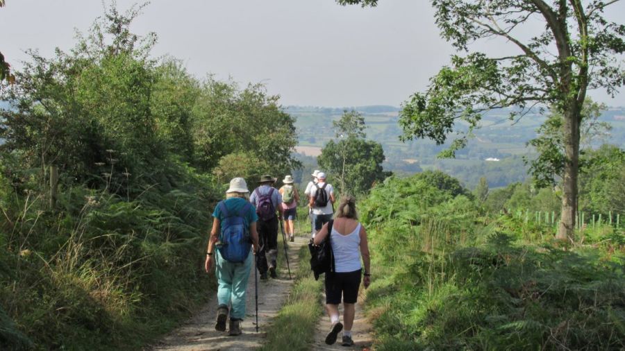
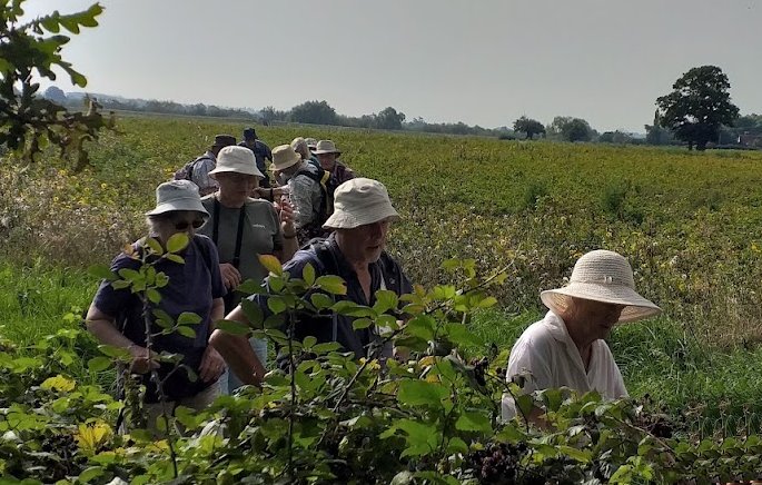
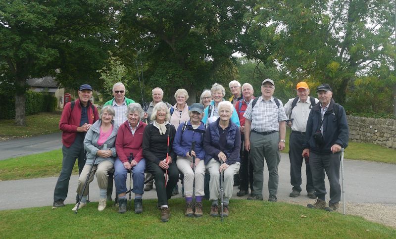
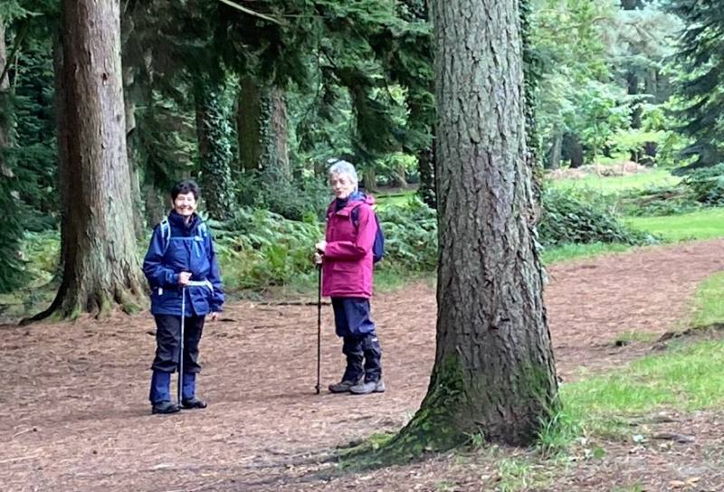
Fourteen of us met at Norbury farm near Malvern on a beautiful September morning. After about 10 minutes walking we met up with Noel who gave us an informative insight into the life of Elgar who lived and composed poems in this area.
Afterwards we proceeded somewhat slowly, due to the heat, uphill to the welcome shade of the woods above. We then had a beautiful walk meandering along leafy paths having a welcome coffee stop.
We then continued until we reached Birchwood Farm, made famous due to Elgar staying in the precincts at Birchwood Lodge. We continued - again uphill to the welcome shade of a beautiful tree, where Jenny read to us an excerpt from a book which inspired the creation of this walk.
Afterwards we returned to the farm, negotiating some stiles and some seemingly not well walked paths, which had been cleared thankfully by Mike and Jenny to make them passable for us.
We then had our picnic lunch, where we could find shade before taking advantage of the farm shop produce including home-made cider (reminding me of the Archers!).
Thank you, Jenny and Mike, for a most interesting walk which you must have spent some hours preparing.
Report by Meg and photographs by Margaret and Terry; website by “Stub”.
1, Coffee, shade listing to Noel giving an informative insight into the life of Elgar
2. Birchwood Lodge, visited by Elgar
3. Returning on shady, cleared paths
4. An interesting incident – was it scripted?
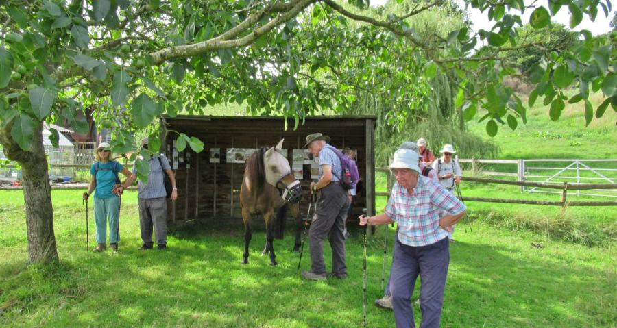
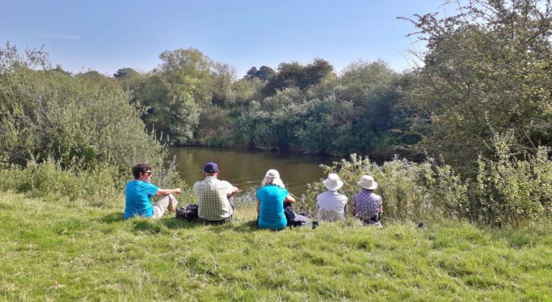
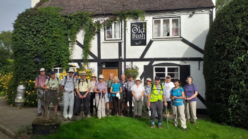
Walk 1578
Thursday
7 September 5 miles
Easy/moderate Pub lunch
Meet Old Bush, Upton Rd, Callow
End WR2 4TE Grid 834494
9.30 for 9.45 a.m. start.
Contact Terry & Margaret
01684 772278 the week
before
Directions North from Upton on Severn on B4424. Pub
is on the left on reaching Callow End (up narrow drive).
Details A circular walk around the village, partly
on the flood plain, which may need altering at short notice if it
floods. Weather dependant.
Terry and Margaret again found a "Walk
with a difference" today. We were told there was one moderate hill
and a number of little ones. The little ones turned out to be
ridges of unharvested potatoes.
Eighteen of us set off under a hazy sun, down old Ferry Lane and
several fields, including the spuds, to reach the River Severn
opposite Kempsey Grove for coffee. It was a very hot day for
September and I think I glimpsed a swallow dashing across the
River. Back across fields to Callow End, we crossed the road
onto the Three Choirs Way, past Stanbrook Abbey. The Abbey had
once housed over 100 monks, and then 9 nuns, but is now an
exclusive hotel. We ascended a stony track, where one of our party
had an unfortunate and painful fall. Our own Florence Nightingale,
aka Sylvia, administered first aid and the casualty was able to
walk back to the road from where Terry collected her by car for
lunch at the Old Bush. Generous lunches were washed down with a
variety of beveraBy the
riverges including some more unusual ales.
Thanks to Terry and Margaret for an enjoyable walk, and everyone
for their good company. (Thanks also to Mike for the report, and
to Margaret and Terry for the photos - SF)
The Old Bush (Margaret)
"If you want to get ahead . . . " (Margaret)
By the river (Terry)
!00 monks
and 9 nuns . . ? (Terry)
Walk
1579
Thursday
14 September 3.5 miles Mostly
Easy food options nearby
Meet Stanton Village Hall WR12
7NE Grid 068346 9.45 for 10.00
start
Contact Sonia 01684 298409
the week before
Directions Tewkesbury to Teddington Hands roundabout
and take B4077 to Toddington roundabout. Turn left onto B4632 and turn
right to Stanton Village. Drive through the village and follow the
curved road to the left and car park.
Details We walk through 3 Cotswold villages and
visit two interesting
churches.
Mostly flat on lanes and fields with one short steep ascent and
undulating paths on the way back. 5 stiles and 3 easy foot bridges.
N.B. If wet, poles will be useful in a couple of places.
Pheasant Inn or Railway Café are food options at Toddington.
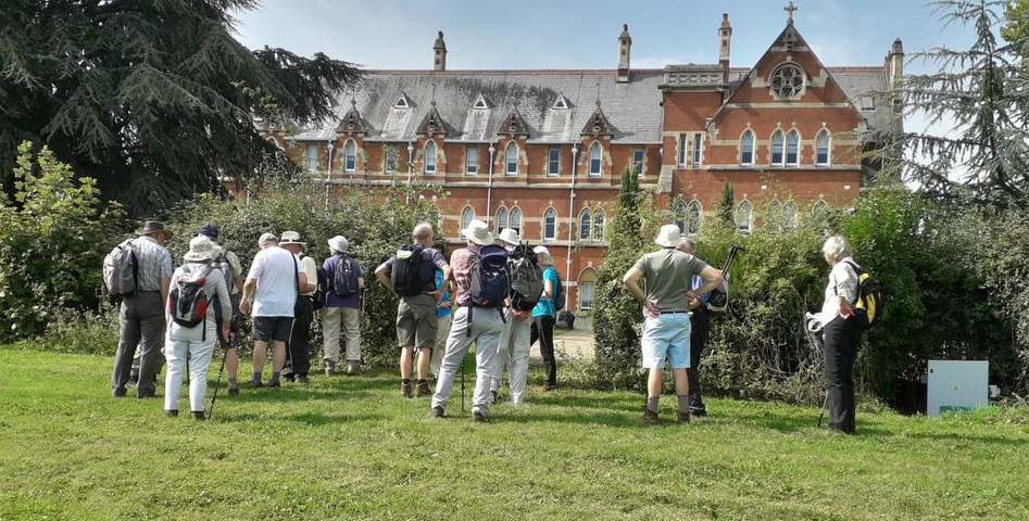
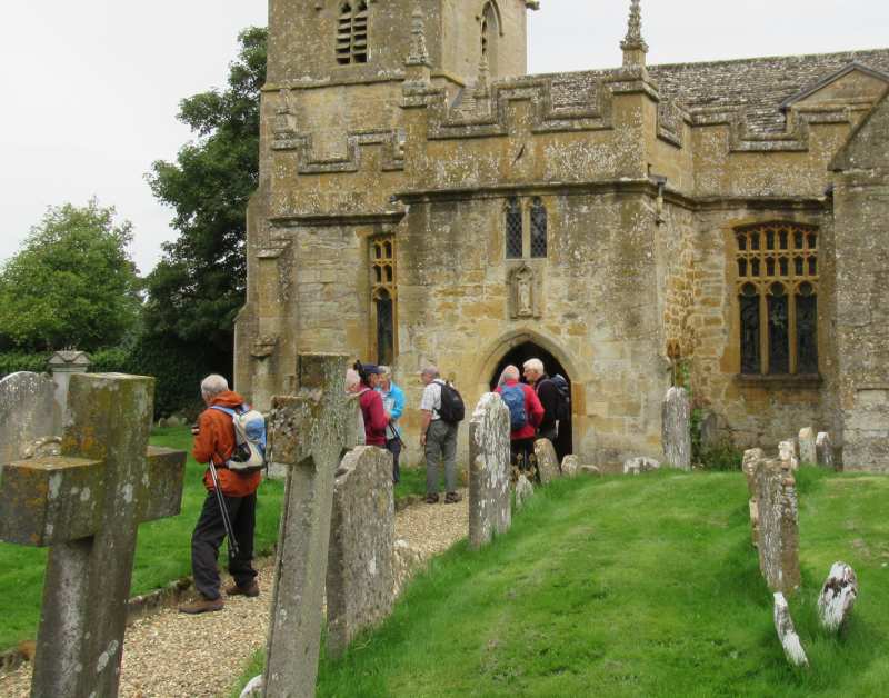
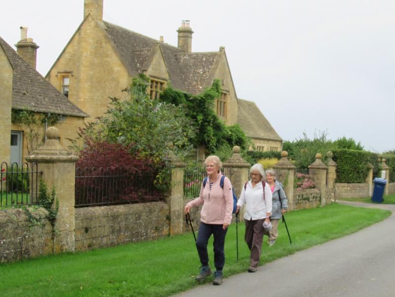
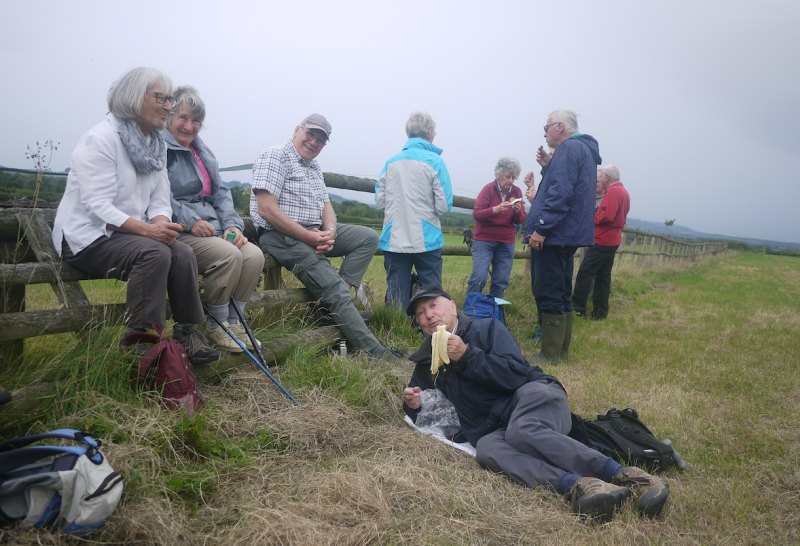
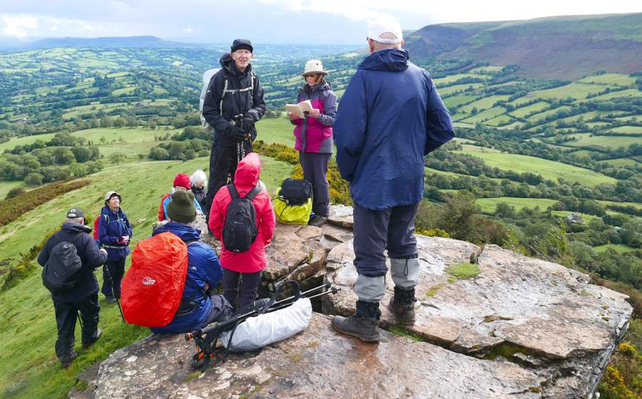
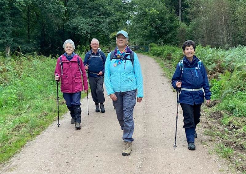
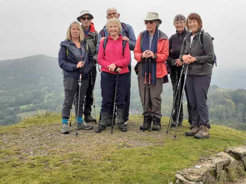
We were 19 on our walk in the Cotswolds, around the villages of Stanton, Laverton and Buckland, led by Sonia. The weather warmish with a hint of rain.
Firstly, Stanton, frequently heralded as the most beautiful village in the area. Stanton church, where residents pick up their newspapers from the church porch in the absence of shops. During our coffee stop between Stanton and Laverton, Anne Trott’s name came up in conversation, she died 2019, so many memories came back, amusing anecdotes from her time with us, a reminder how important friendship is to members in the walking group.
On through the hamlet of Laverton, fine Cotswold stone architecture glows even on sunless days. Quieter than popular Stanton, not so discovered - no pub for one thing. Next, we came to Buckland, an attractive tree-shaded village, with 15th century rectory, the oldest parsonage in Gloucestershire and still in use. In the 18th century, however, it was used by Methodist preacher, John Wesley! The unexpected richness of Buckland church, with medieval glass, restored by William Morris, was thought to have come from Hayles Abbey at the Dissolution. Then handsome Buckland Manor, now a hotel - some said it is very expensive!
Villages visited, we returned to Stanton along the undulating paths on the lower slopes, enjoying the panorama of the neighbouring hills, the Malverns, Bredon and nearby Dumbleton – it was a reminder of how fortunate we are to walk in such beautiful places. Thank you, Sonia, for a memorable walk.
Report by Betty; photographs by Terry and Bob W; website by “Stub”.
1. a service to inspire the walk?
2. do not step on the neat lawn edges!
Stroll
Tuesday
19 September Pershore Abbey Park 1 mile or
less if you wish
Meet Abbey Park Car Park -
Pershore, Pershore WR10 1JP. Pay & display by card/coins: £1 per
hour; (Blue badge holders free). For a 10.45am start
Contact Angela &
Chris 01684
294325 the week
before
Directions Leave Tewkesbury by Worcester
Road, A38. At M50 junction, straight ahead on A38 towards
Upton on Severn. At new Upton roundabout, take 3rd turning, A4104
for Pershore. At 30mph sign entering Pershore, go straight ahead.
At small roundabout go straight
ahead, 2nd exit. Turn 2nd
right into Newlands (signposted high up for Abbey), this
is a narrowish road where everyone gives way. At the
roundabout, take the 2nd exit into the car park
Details We stroll in and
around Pershore Abbey Park that includes a war-horse memorial,
community orchard and wetlands. There are information boards about the
origin of the park and Pershore Abbey which you may visit at
your leisure. All paths are tarmac, entirely suitable for
mobility scooters. There are benches around the park to take in
the views.
Lunch There are
numerous cafes & inns in Pershore close at hand, including
Number 8, the café linked with the town’s cinema.
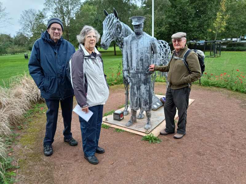
Four of us met in the Pershore Abbey Park
car park on a windy, grey day with some occasional light rain. On
a day with better weather this stroll would have been utterly
delightful. Pershore Abbey park is beautifully kept with an
interesting war memorial, including one to the 0.75 million horses
lost in the Great War. There is a small wetland nature reserve,
various history boards, interesting wood carvings and very good
children's play areas. We finished with a brief look inside
Pershore Abbey which has just had a new organ installed. Thank you
to Angela for an original and interesting stroll. (Report and
picture from Hugh)
Walk 1580 Walk Cancelled due to poor weather
Wednesday
20 September 5 miles
Moderate Pub Lunch
Meet Shutters Inn,
Gotherington, car park GL52 9EZ Grid SO957297 what3words:
scam.mentioned.bravest for a 10.00am start
Contact John & Guy
01684 491388 the week before
Directions From Tewkesbury A46 to Aston
Cross. Right on B4078 to join A435 towards Cheltenham.
Gotherington is third turn on the left. The Shutters is on the
right just after the turning to the left to Woolstone.
Details An undulating walk around the Tirle Brook
valley near Gotherington with some stiles. If you would like lunch
at the Shutters Inn afterwards please visit their website
https://www.theshutterinngotherington.co.uk/index to look at their
lunchtime menu and place your order with John & Guy when booking
the walk.
report
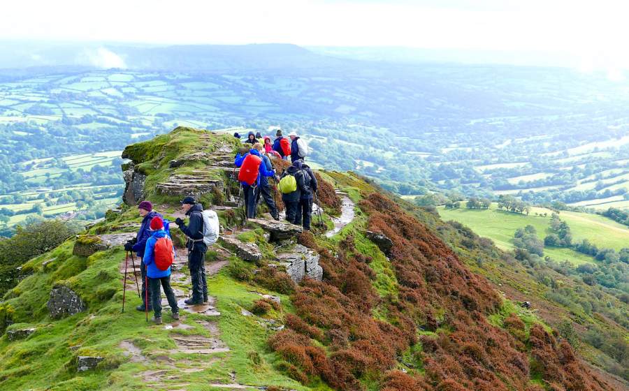
Walk 1581
Thursday
21 September 5 miles
Energetic Picnic en route
Meet Little Black Hill (Cats
Back)* Car Park near Longtown, Herefordshire HR2
0NL Grid SO289329 for 10.00am start
Contact Graham & Betty 01684594331 or email
graham.mealand@btinternet.com the week before.
Directions Travel M50 to end, A40, A49, B4348 to
A465. Turn L on A465 to Pontrilas. Turn R onto B4347 to Ewyas
Harold. In Ewyas Harold turn L to Longtown. In Longtown take Olchon
Valley to LLanveynoe and Little Black Hill CP looking out for Brown
Picnic (tree) signs en route . This road is narrow!
Alternatively, from A49 take L on B4521 to Skenfrith and R on B4347 to
Grosmont and Pontrilas etc.
(Important-* Share Cars as this Car Park has limited space) Allow 1.5
to 1.75 hours from Tewkesbury, suggest 8.00 am start.
Details Starting from the Car Park we follow the approach road down
turning right leading towards the Cats Back ascent.This gradual uphill
rocky path has wonderful views across the Olchon Vally leading to the
ridge top and the Black Hill ( Cats Back) trig point, 640m. It is
along this ridge that we’ll have a lunch stop, then proceeding towards
the well known rocky outcrop before a long steep descent to the car
park. Elevation Gain 301m. Approx 3+ Hours
Please note: Take waterproofs, walking poles and extra layers plus
plenty of fluids whatever the weather!
After our walk we have arranged for a short drive back to Longtown
where we can have a tea/coffee & cake stop at Hopes Farm shop, HR2
0LT.
We last walked a longer version of this walk in July 2019 and we will
be enjoying the same magnificent views again on this
shorter route.
See
https://www.wanderingwelshgirl.com/black-hill-herefordshire-walk-cats-back/
for a description and video. Scroll down to Black Hill. We walk this
route clockwise not anticlockwise as in the video.
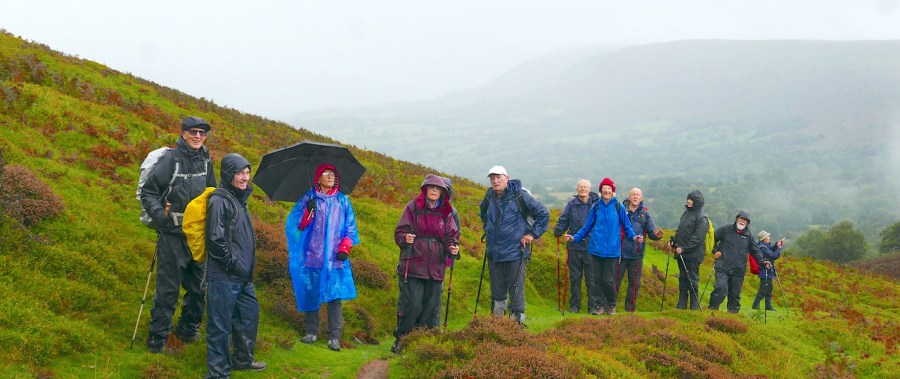
For once we had
three coinciding weather forecasts suggested that the worst we might
encounter would be a few showers. Arriving at the Black Hill car park
in teeming rain, the bakers' dozen of us donned foul weather gear and
set off up the Olchon Valley, crossing small streams and
admiring the little waterfalls. There were probably as many ponies on
the hill as there were of us, and they and/or the sheep had devoured
all the fruit off the bilberries, to my dismay as they are my
favourite wild fruit.
As we turned sharply from the top of the valley towards the trig
point, the weather improved, the sun shone weakly and from there
onwards the Southerly views continued to improve. Lunch was taken on
the ridge, overlooking the Golden Valley to the East and the
Hatterall Ridge to our West. The descent was taken with care, the
rocks seemed fine but the mud caused a few slips here and there. As
well as co-leading with Betty, Graham remembered to take a few group
photographs with a real camera. Meg read us a few pages from Bruce
Chatwin's book, "On the Black Hill" about two brothers, born in the
year 1900 who lived their whole lives in their family cottage nearby.
On our journey back to Tewkesbury, some of us stopped for tea at
Hope's emporium in Longtown, which Graham and Betty had, of course,
checked out at breakfast time. We were treated to chocolate cake and
flapjack by Guy and John, a fine end to a great day out despite the
weather being not quite perfect.
Thanks to Betty and Graham for a memorable and very enjoyable day in
the hills. (Thanks also to Mike for the report of this special
walk, and to Graham for the spectacular photos - SF)
Up
the Olchon valley in the wet.
Walk 1582
Wednesday
27 September 4.5. Miles
Easy. Pub Lunch or picnic
Meet New Fancy View car park,
Forest of Dean GL15 4HS Grid 628096
9.45 for 10.00am start
Contact Phil 07909108144
the week before
Directions A38 towards Gloucester, right turn onto
A40. Follow A40 to junction with A48. Turn left and follow A48 through
Westbury on Severn to Texaco Service Station on right. Turn
right on A4151 towards Littledean. Through Little Dean to St Whites
Road. Along this road to Speech House Road. On reaching Speech House
turn left. Follow road for 1.75 mile. Car park on left hand side.
Details A mainly flat and easy circular walk along
forest tracks and trails with a coffee stop at Speech House Lake and a
stroll through the arboretum. One 300 yard stretch of road walking
right at the end. Mainly dry, but can be muddy in places following
rain. No stiles but one small stretch of path with thorny vegetation.
Shorts not recommended.
Possible meal at Speech House. No bookings accepted.
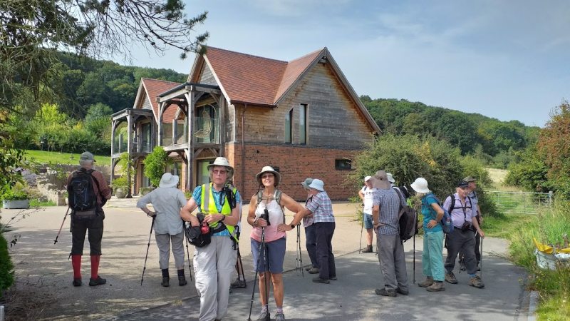
Six of our staunchest members, braving the
Met Office forecast, gathered at New Fancy, an old mine with a 360
degree viewpoint.....pity about the mist.
After welcoming Brenda, a new member to the
group, Phil led us onto the old Lydney to Lydbrook railway line
under, of course, our own steam. Why let Calvyn have all the
jokes?
Arriving at Speech House Lake, the mystical
Lake of Avalon in the TV Merlin series, Phil chose our coffee stop
close to the last pink water lily in flower – just in time!
Then, negotiating fallen trees, it was on to an
arboretum near Speech House, where our leader took a 'fancy' to
the monkey puzzle trees. This was created in 1915 by the
plant hunter Ernest Wilson from his 1910 explorations of China.
Our leader then led us on what seemed a high
risk return route via 'Wet Wood' but, like the threatened 'Storm
Agnes', there were more spots of sunshine than of rain.
Thus, we all returned in the dry, before stopping off at Speech
House for an attractively presented lunch. Apparently, we
all have Charles 2nd to thank for expanding the Verderers' Court
into a hunting lodge with 'facilities'.
Thanks are due to Phil for leading our walk in
the Forest, full of historical associations, aided by Sylvia on
both the walkover and walk,not to mention being our
photojournalist for the day.
Thanks also to Noel for his usual entertaining report and to
Phil for taking time out from his leader duties to supply the
photos - SF)
Walk 1583
Postponed -
Thursday 28 September
7.5miles Energetic
picnic lunch en route, tea in Ledbury
Meet Swimming Pool car park,
Lawnside Rd, Ledbury, HR8 2AE Grid 708375 (£3.50 all day)
Contact Noel on 01684 772526 the week before
Directions A438 to Ledbury; turn right at main
crossroads in town; first turn left at clock tower into Bye St;
second turn right into Lawnside Rd (swimming pool car park at end)
Details Walk from car park at 9.20AM exactly 1km
plus to station to catch 10.00a.m train, single to Colwall
(£4.70). Walk back via Evendine, steep climb to Ridgeway,
Netherton Farm, Kilbury Camp, Old Worcester Rd, Ledbury
churchyard, Tea at Malt House Cafe
Going: cross country Herefordshire!!! Ascent: 800ft
Expansive views N S E and W
Walk 1583 (New)
Thursday 28 September 6 Miles
Easy Picnic lunch or own arrangements
Meet Tewkesbury Nature Reserve
Car Park Grid 900320 at 9.45am
Contact Ian or Kathy 01684
290542 the week before.
Directions The Car Park is sign posted off first
roundabout on the Tewkesbury By-Pass as you head away from the traffic
lights at Morrisons.
Details An easy, flat walk across fields, tracks and
country lane. Nettles could be a problem in the early stages of the
walk.
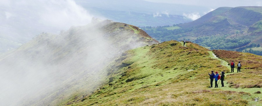
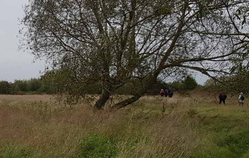
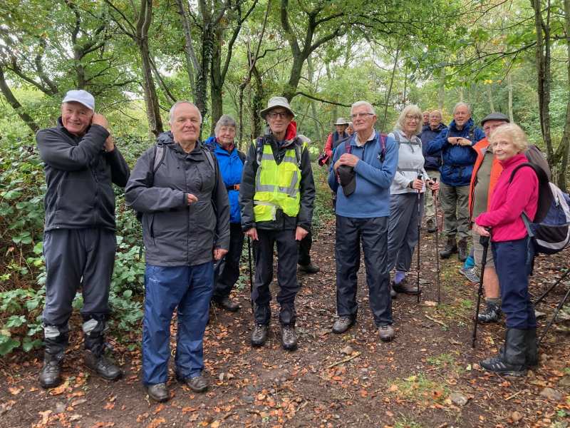
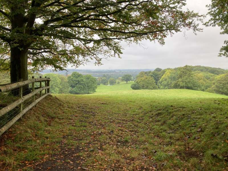
In the calm following Storm Agnes, 14
walkers met at Tewkesbury Nature Reserve on a grey but dry
day. Our walk began across the sheep pasture of the
reserve, before crossing the causeway and joining the
Gloucestershire Way. From here we walked across pastures
which form part of Tewkesbury's flood plain , often under
water in the winter months, before joining the lane passing the
old Walton Cardiff Manor. Walking along lanes and tracks
, we crossed the motorway and railway to Claydon
farm before reJoining the Gloucestershire Way . Returning
now through rough pasture land we surprised a large hare
and had the opportunity to watch it zig zagging
across this open space to find safe haven. Coffee at last,
we enjoyed a short stop by the field hedgerow for
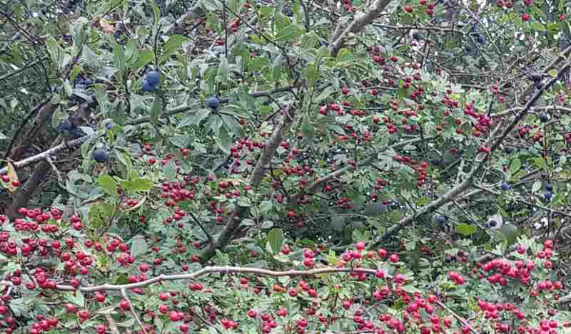
refreshment. Throughout our walk the hegedgerows have been covered
with sloes and red hawthorn berries reminding us that autumn
is well underway. Stopping only to let a Mainline
Express thunder by at a point where our path crossed the
rail track, we walked back towards Tewkesbury skirting by the
"Dobbies" new development , goodbye greenbelt, then back
through Walton Manor to the car park on the nature reserve.
Our thanks to Kathy and Ian for showing us a very pleasant
and enjoyable walk right here in the countryside around
Tewkesbury., (Report and pictures from Jim - SF)
Walk
1584
Wednesday 4 October 5.5 miles
Easy Pub lunch
Meet Gupshill Manor car
park GL20 5SG for 10.00 am start.
Contact Sue 01684 298085 or Jill
01684 276063 with menu choices when booking the week before.
Directions A38 south, the hotel is on Gloucester
Road about 0.8 miles from Tewkesbury Abbey.
Details We follow lanes and field paths to Deerhurst
and return along the Severn Way and beside the golf course at The
Park. Lunch menu at https://gupshillmanor.com/menus/
Fifteen
of us met at the Gupshill for a walk which took in Deerhurst,
the Severn and Tewkesbury park golf course. As we walked along
the Severn way we walked through a herd of about fifty cattle
(bullocks?). As we emerged from the far side of the herd, so
too did Noel who had come to join us half way round, so
fifteen became sixteen. The weather had started off as grey,
dry and cool but later the sun came out and we were in
shirtsleeves. Credit to the golf course who had kept their
portion of the public footpath beautifully. As we passed
Sylvia's house she was in the back garden so we had a chat.
Lunch was then enjoyed at the Gupshill. Thank you Sue
and Jill. (Thanks to Hugh for the report - SF)
The length of the Malverns -Two walks
(1585A & B): Thursdays 5 and 12 October.
We will do a car shuffle to get to the start of each walk, leaving
half the cars at the end. Since some cars will have to pay to
park at Wynds (British Camp) and others not, we will make a charge
of £1.50 per head to make a kitty to pay for parking. Both
walks will end at Wynds where we will be able to buy suitable
refreshments before driving back to the start to collect cars.
N.B. We need to arrive with at least 2 spare seats in our cars to
perform the shuffle.
Walk 1585A
Thursday 5 October 5.5
miles Energetic Picnic
Meet British Camp car park at
Wynds on A449, Malvern WR13 6DW Grid 763404 at 9.30am. We will
leave half the cars at Wynds and drive to Tank Quarry WR14
4NA Grid 769470 to start the walk, (don’t pay for
parking until you know which cars are staying) Take A449
through Malvern, Left towards West Malvern. Go past main car
park and Clock Tower. Road up to Tank Quarry picnic place on the
left.
(You can go West of the hills to West Malvern but road to Tank Quarry
would be a sharp right. Might need to go on to main car park and
turn)
Contact Mike and Jenny
01684 772194 the week before.
Directions A38 To Upton on Severn then A4104 through
Welland to A449, left to British Camp car park.
Details Tank Quarry to Wynds. We walk over End Hill,
and Worcestershire Beacon to the Wyche (coffee and toilet stop) then
on to Wynds. The more energetic can do all the tops.
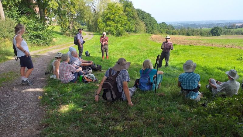
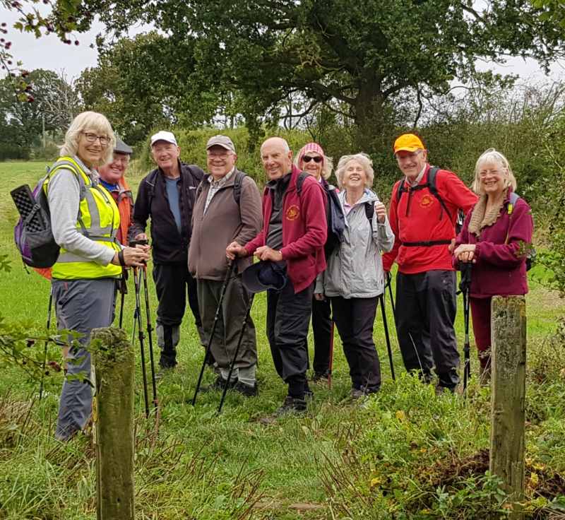
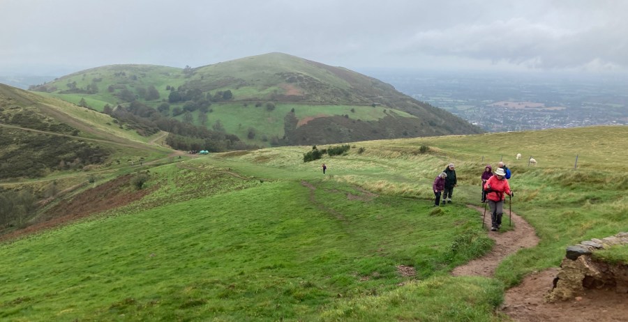
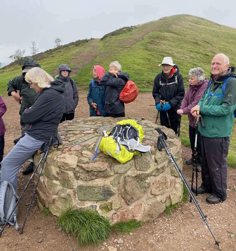
This was part one of the Walk the Malverns expedition. Sharing cars for this linear walk is always complicated but Jenny had the matter in hand. Money was taken, fees paid and places allotted and we 20 walkers were soon on our way to the start at Tank Quarry. There was some light rain, but this soon stopped.
The path up to End Hill seemed steeper this year. Had there been some seismic activity recently that had pushed the Malverns higher? After a brief rest, those - with the lung power - carried on via the tops of North Hill and Sugarloaf, whilst the ‘weaker’ took the lower path, saving their energy for the ascent of the Worcestershire Beacon.
Views from the top were limited. There was low cloud, so we were glad of the downward path into weak sunshine to reach the coffee stop at The Wyche. After a rest, the final section of the walk followed the same pattern as before: the ‘fit’ over the tops and ‘those with less energy’ along the lower paths.
A picnic was had just before the car park. Thanks to Jenny and Mike for organising things so well.
Richard, photos from Sylvia and Meg , website by ‘Stub’
Stroll
Tuesday 10 October Historical Tour of Tewkesbury
town Possible pub lunch
Meet Back of Avon in the American
Garden at the rear of the Town Hall, Tewkesbury, GL20 5AQ at 10.30am
Contact John and Jan 07747727703
by 9 October
Details The route is short but there is lots of
History to discuss:
Lunch If any wish to join us, we shall probably eat
at the Tudor House – please let us know when you book if you wish to
join us.
report
Walk 1586
Walk Cancelled - leader injured
Wednesday 11 October
3.75 miles (approx) Easy
Possible pub lunch
Meet Main Street, Dumbleton
WR11 7TG(near) outside church. Street park as convenient & safe.
At 10.15 for a 10.30a.m. start.
Contact Barry 07751170833 or
email barryms1942@gmail.com the week before.
Directions A46 passed Teddington Hands roundabout,
after 1 mile right turn signed to Dumbleton.
Details An easy walk over fields with four
stiles, possibly some mud. Possible pub lunch at the Hobnails Inn,
Little Washbourne, Tewkesbury GL20 8NQ.
Walk
1586 (New) Walk Cancelled
Wednesday 11 October 3.5 miles Easy Lunch own arrangements
Meet Cheltenham Racecourse Park and Ride GL50 4SH 10.15 for a 10.30a.m. start
Contact
Bob
01242 232527 this week
Directions Just after Racecourse roundabout on left of B4075 Prestbury road.
Details This is a walk around the racecourse and through part of Prestbury
report
The length of the Malverns -Two walks
(1585A & B): Thursdays 5 and 12 October.
We will do a car shuffle to get to the start of each walk, leaving
half the cars at the end. Since some cars will have to pay to
park at Wynds (British Camp) and others not, we will make a charge
of £1.50 per head to make a kitty to pay for parking. Both
walks will end at Wynds where we will be able to buy suitable
refreshments before driving back to the start to collect cars.
N.B. We need to arrive with at least 2 spare seats in our cars to
perform the shuffle.
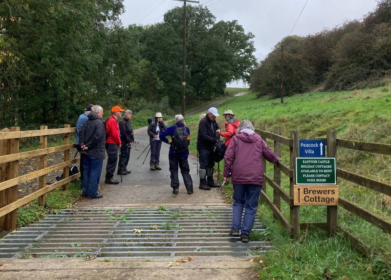
Walk 1585B
Thursday October 12 6.5 miles
Energetic Picnic
Meet British Camp car park at
Wynds on A449, Malvern WR13 6DW Grid 763404 at 9.30am. We
will leave half the cars at Wynds and drive to Hollybush (nearest post
code HR8 1ET Grid 758368) to start the walk, (don’t pay for
parking until you know which cars are staying). A449 towards
Ledbury. Sharp left onto A438 Eastnor to Hollybush. Car Park on
left at top of hill.
Contact Mike and Jenny
01684 772194 the week before.
Directions A38 to Upton on Severn then A4104 through
Welland to A449, left to British Camp car park.
Details Hollybush to the bottom of Chase End then
back to Wynds. We take the West path to Whiteleaved Oak,
over Chase End then back on the East side to Hollybush and on to
Wynds. The more energetic can go over Ragged Stone, Midsummer
and British Camp.
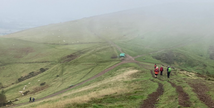
18
hardy walkers gathered at the British Camp ready for part 2 of
the Malverns end to end walk.
After dividing up the transport we set off to car park at
Holybush, and walked around Ragged Stone and up and down Chase
End there to properly begin the start.
A choice was given and four opted to take the assault on
Ragged Stone, having been one of the four one has to wonder
why ??. The descent on wet grass was quite difficult but
fortunately all well to meet the group again at the car park.
No one opted to take the climb of Midsummer Hill, and we took
the Three Choirs Way as far as Hangmans Hill.
At Shire Ditch we stopped for lunch, which was fortunate as
the tummy rumbles made a few wonder if thunder was in the air.
Four of our party departed there having assorted appointments.
So with those departed our walk now became a “four gone”
conclusion we carried on our way to the next decision point.
Either ascend Millenium Way and then British camp or continue
on around the side. Again time constraints (that’s my excuse
and I’m sticking to it) meant 4 went around the edge while
those remaining took on the hills.
We were very fortunate with the weather as rain had been
forecast but we had nothing but a lovely walk all completed
with no mishaps. Thanks to Mike and Jenny for all the effort
in planning and for sorting out the logistics to get everyone
back to the right places with the right cars. (Thanks to
Calvyn for his ever entertaining report, to Ruth for her
(first of many?) photograph, and to Syvia for her most welcome
pictures - SF)
On the top! (Ruth)
Woodland walking (Sylvia)
Chase End (Sylvia)
This way to the beer! (Sylvia)
Camino
Presentation
Wednesday 18 October
Venue Holy Trinity Church, 10
Oldbury Road, Tewkesbury, GL20 5NA at 2.00pm
Details A presentation of the Camino de Santiago
Pilgrimage, which was recently undertaken by 14 members of our group.
The presentation will be by several of the pilgrims who will share
their memorable experiences and amusing anecdotes supported by photos.
Tea and coffee will be served and donations of cakes will be welcome.
report
Walk 1587
Thursday 19 October 5.5
miles
Moderate/energetic
Pub lunch
Meet Red Lion, Stiffords Bridge,
Cradley, WR13 5NN Grid 734480 9.30 (to order lunch) for
!0.00am start
Contact Jim & Margaret
01684 296773 week before
Directions From Great Malvern go northwards along
the A449 taking the turning on the L.H.S. A4219 to Bromyard.
After a few hundred yards the road branches, with the A4219 (Cowliegh
Rd) on the R.H.S. Keep to the A4219 (Hereford and Bromyard) until it
meets the A4103. Turn left towards Bromyard. The Red Lion is on
the L.H.S. of the road in about 1mile.
Details A pleasant walk through meadows and
woodland passing ancient Cradley church. Fairly long , steady
slope up to Cockshot Hill with good views from the top.
Unfortunately the pub will not be open for us either before or after our walk.
We will still meet there at 9.30am as arranged. We are welcome to use the car park . Food will now be " own arrangements
report
Walk 1588
Wednesday 25 October 5
miles Easy
Pub lunch
Meet Tewkesbury Nature Reserve
car park Grid 900320 off Tewkesbury ring road 10.00
start
Contact Richard and Ken
Richard.hart13@btinternet.com the week before
Directions 1st roundabout from the Morrisons end of
the Tewkesbury ring road.
Details To Tredington and back via lanes, tracks
following the Swilgate. Could be some mud if it has been
raining.
There is a Hungry Horse pub very near the car park so if you want to
eat there, let us know and we will reserve a table. We
can’t pre-order but service is usually very quick.
report
Notes for Guidance
Information for all members (revised July
2020)
Group Leader Walks
Co-ordinator
Treasurer
Sylvia Murdoch
Hugh Bennett
Tony
Barrett
01684 437462
01452 780460 01684 276960
sylviamurdoch@outlook.com
candhbennett@gmail.com
tonyandjenniferbarrett@btinternet.com
Walking
Group mobile phones: 07546069085 and 07522958435
Details
of all walks and reports can be seen at
http://home.freeuk.net/stanfagg/u3a.html
Nearly
all the photos on this page have been reduced in size and resolution
to save both space and bandwidth. Should you want a copy of any
of the photos, Stan would be happy to supply a copy of the original
file - just quote the walk number and the photo title.
To go to The Tewkesbury U3A main site click here; Tewkesbury U3A
Contacts:
Sylvia (Group Leader) 01684 437462
E Mail sylviamurdoch@outlook.comHugh, (walks coordinator) 01452 780460 E Mail candhbennett@gmail.com
Webmaster . . . Stan Fagg stanfagg@freeuk.com Updated 6th Oct 2023